
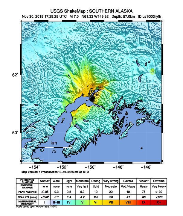
Tiedosto:2018-11-30 Anchorage, Alaska M7 earthquake shakemap (USGS).jpg
Tämän esikatselun koko: 509 × 600 kuvapistettä. Muut resoluutiot: 204 × 240 kuvapistettä | 612 × 721 kuvapistettä.
Alkuperäinen tiedosto (612 × 721 kuvapistettä, 141 KiB, MIME-tyyppi: image/jpeg)
.jpg)
Yhteenveto
| Kuvaus | |
| Päiväys | |
| Lähde | https://earthquake.usgs.gov/earthquakes/eventpage/us1000hyfh |
| Tekijä | Yhdysvaltain geologian tutkimuskeskus |
Lisenssi
Tämän teoksen on valmistanut Yhdysvaltain geologiaviraston (United States Geological Survey, USGS) työntekijä osana kyseisen työntekijän virkatointa. Yhdysvaltain liittovaltion viranomaisten työntekijöiden tekemät teokset eivät saa tekijänoikeuden suojaa Yhdysvaltain tekijänoikeuslain 105 § mukaisesti.
|
Tiedoston historia
Päiväystä napsauttamalla näet, millainen tiedosto oli kyseisellä hetkellä.
.jpg&dir=prev)
.jpg&offset=&limit=20)
.jpg&offset=&limit=50)
.jpg&offset=&limit=100)
.jpg&offset=&limit=250)
.jpg&offset=&limit=500)
.jpg&offset=20181206163121)
| Päiväys | Pienoiskuva | Koko | Käyttäjä | Kommentti | |
|---|---|---|---|---|---|
| nykyinen | 6. joulukuuta 2018 kello 19.02 | | 612 × 721 (141 KiB) | Cewbot | Import USGS updated earthquake map, shakemap id: urn:usgs-product:us:shakemap:us1000hyfh:1543965822964 (2018-12-04T23:23:42.964Z) |
| 6. joulukuuta 2018 kello 19.02 |  | 612 × 721 (141 KiB) | Cewbot | Import USGS updated earthquake map, shakemap id: urn:usgs-product:us:shakemap:ak20419010:1543967384998 (2018-12-04T23:49:44.998Z) | |
| 6. joulukuuta 2018 kello 18.31 |  | 612 × 721 (141 KiB) | Cewbot | Import USGS updated earthquake map, shakemap id: urn:usgs-product:us:shakemap:us1000hyfh:1543965822964 (2018-12-04T23:23:42.964Z) | |
| 6. joulukuuta 2018 kello 18.31 |  | 612 × 721 (141 KiB) | Cewbot | Import USGS updated earthquake map, shakemap id: urn:usgs-product:us:shakemap:ak20419010:1543967384998 (2018-12-04T23:49:44.998Z) | |
| 6. joulukuuta 2018 kello 18.01 |  | 612 × 721 (141 KiB) | Cewbot | Import USGS updated earthquake map, shakemap id: urn:usgs-product:us:shakemap:us1000hyfh:1543965822964 (2018-12-04T23:23:42.964Z) | |
| 6. joulukuuta 2018 kello 18.01 |  | 612 × 721 (141 KiB) | Cewbot | Import USGS updated earthquake map, shakemap id: urn:usgs-product:us:shakemap:ak20419010:1543967384998 (2018-12-04T23:49:44.998Z) | |
| 6. joulukuuta 2018 kello 17.31 |  | 612 × 721 (141 KiB) | Cewbot | Import USGS updated earthquake map, shakemap id: urn:usgs-product:us:shakemap:us1000hyfh:1543965822964 (2018-12-04T23:23:42.964Z) | |
| 6. joulukuuta 2018 kello 17.31 |  | 612 × 721 (141 KiB) | Cewbot | Import USGS updated earthquake map, shakemap id: urn:usgs-product:us:shakemap:ak20419010:1543967384998 (2018-12-04T23:49:44.998Z) | |
| 6. joulukuuta 2018 kello 16.31 |  | 612 × 721 (141 KiB) | Cewbot | Import USGS updated earthquake map, shakemap id: urn:usgs-product:us:shakemap:us1000hyfh:1543965822964 (2018-12-04T23:23:42.964Z) | |
| 6. joulukuuta 2018 kello 16.31 |  | 612 × 721 (141 KiB) | Cewbot | Import USGS updated earthquake map, shakemap id: urn:usgs-product:us:shakemap:ak20419010:1543967384998 (2018-12-04T23:49:44.998Z) |
Tiedoston käyttö
Seuraava sivu käyttää tätä tiedostoa:
.jpg)